Water is the defining resource for civilization. Regular access to clean water and timely management of wastewater is essential to societal longevity. Scarcity of either can equal demise, while water control and capacity engender power and authority. New soils research reveals that keen, adaptive ancient Maya water engineering kept their powerful urban centers afloat year-round.
Ancient Maya civilization spread across swaths of Mexico and Central America, including Guatemala, El Salvador and Honduras. El Perú-Waká is a well-studied Maya city site in northern Guatemala that was occupied from about 500 BC to 800 AD.
Recently, North Carolina State University soil scientist Matt Ricker collaborated with archaeologists and geographic information systems (GIS) researchers to refine existing knowledge of early Maya water management. The team’s study, funded by the GeoOntological Development Society and the National Geographic Society, provides a fresh perspective on ancient infrastructure and its implications.
Unique Site Selection
El Perú-Waká citizens enjoyed a prime geographical site. The high escarpment and relative proximity to brackish waterways were advantageous for defense and trade. However, the site has no potable water and sits atop unique geological features that limit surface water collection and can contaminate the jungle rainwater. Early Maya demonstrated sharp architectural and engineering skills to adapt their water management strategies and thrive for centuries.
As Waká developed, the expanding urban center, comprised of stucco structures and limestone paving, created an impermeable surface that threatened flooding from frequent jungle rains.
To manage recurring flooding threats and capitalize on naturally potable water, the Maya directed rainfall to numerous constructed reservoirs to turn a water hazard into a storage opportunity that became a great advantage during the six-month-long dry season.
“We can see changes in some reservoir soils from agricultural land use with irrigation ditches that were later capped with access terraces. It suggests that there was not only adaptive management to local water needs and availability, but also, as the city grew, the need for urban stormwater management grew relative to the need for agriculture in the city core.”
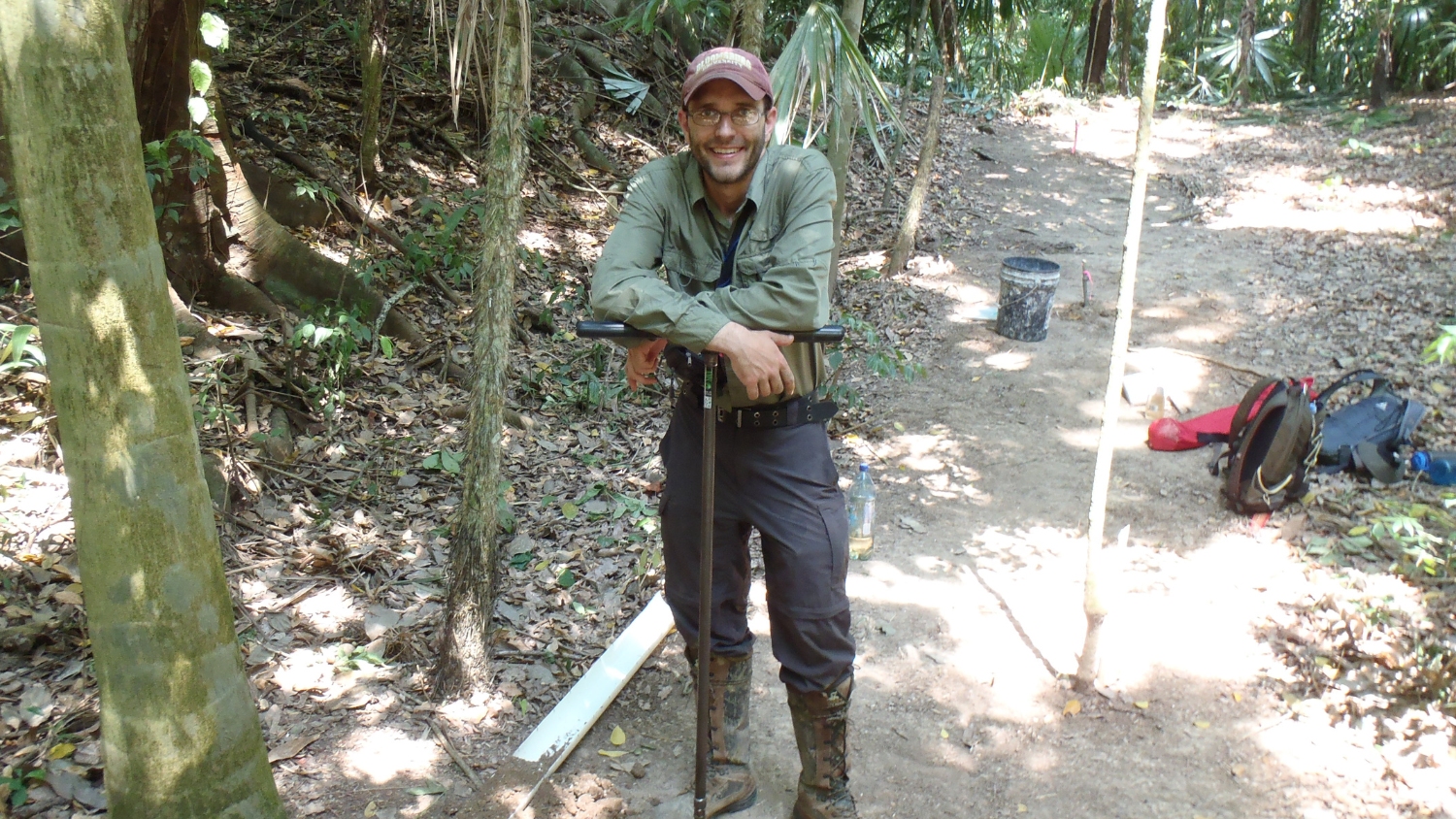
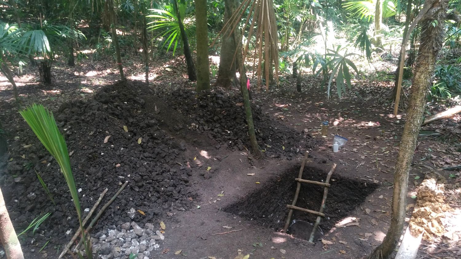
Ricker and his colleagues studied four of the numerous known Waká reservoirs, which vary in size, construction and distribution throughout the site. Documenting the site’s water capacity was initially done by laborious ground measurement and, more recently, by LiDAR. While both methods captured surface measurements, the ground-based methods were essential to tell the full story. Ricker painstakingly recorded soil profiles within and around the Waká reservoirs, allowing him to account for a significant hidden variable — erosion.
In a city that has been abandoned for over a thousand years, Ricker says that surface measurements can be misleading. New soil deposits in the low-lying water reservoirs obscure details and can dramatically impact interpretations.
“We’ve found one to nine feet of slope wash in some areas,” he said. “When you add that up over acres of land, it is potentially tens of thousands of cubic feet of water more than estimated from LiDAR data alone. For the truest measurement, you have to get on the ground and combine fieldwork with geospatial techniques.”
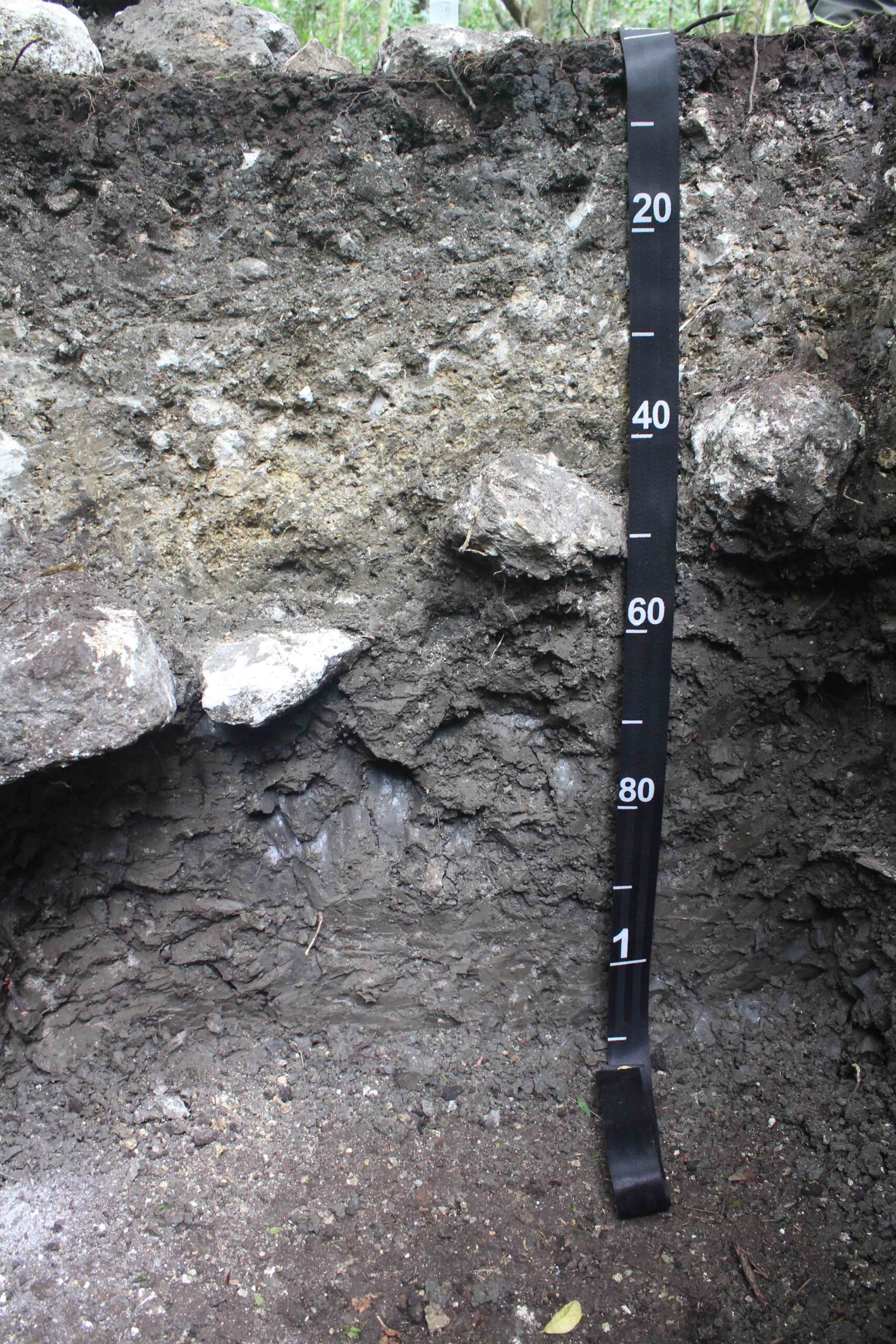
A soil profile at one Waká reservoir showing slope wash (in the 0-30 cm depth) over engineered limestone floor (at 30-60 cm) over native soil.
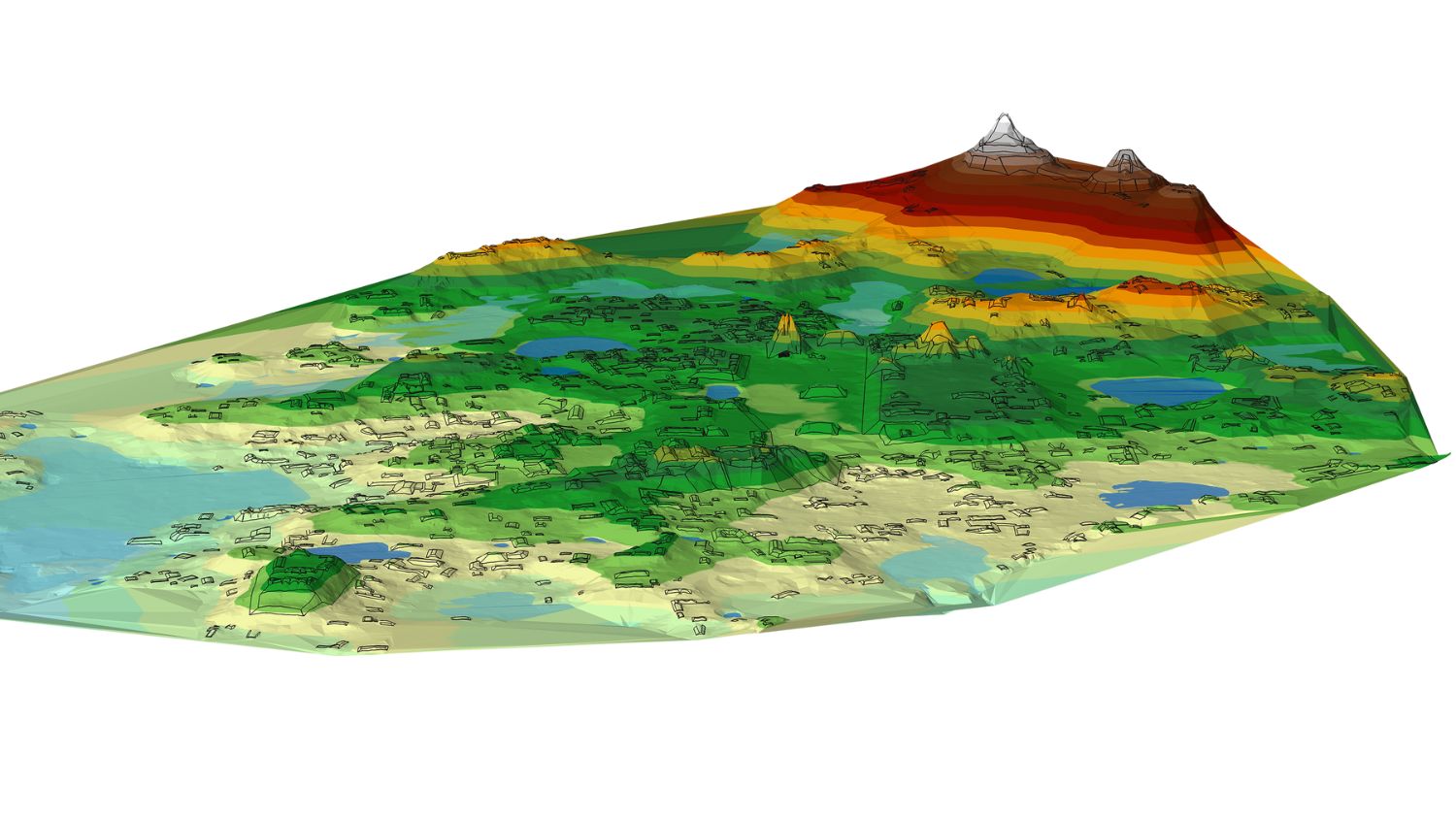
The group turned to geographic information systems to digitally excavate what nature concealed. NC State GIS expert Rob Austin paired below-ground measurements with their GPS locations to peel away the layer of sediment that had accumulated since the Waká city core was abandoned.
“We commonly use GIS to visualize and map our present-day surroundings, but it also provides us with the tools to model and uncover information about the past,” Austin said.
Locally Adaptive Water Management
From 2016-2018, Ricker spent 96 days on the Waká ground, taking measurements and soil core samples by hand in the remote jungle landscape. His fieldwork, coupled with lab investigations and GIS work at NC State, revealed an overall 39% increase over previous estimates in the water-holding capacity of the reservoirs studied. The findings are significant, demonstrating that these four reservoirs alone could have sustained the entire 3,000-5,000 person population through a four-month dry season.
The Waká research team’s work combines archaeology, soil science and geospatial techniques to get a better picture of the water-holding capacity and functionality of ancient water systems. The team layered these data to drive their interpretations of why these landscape features were intentionally sited and their purpose.
“Each reservoir had a different management technique – some reservoirs were routinely dredged, while others were limestone-lined to buffer water-contaminating soil salts. That suggested the decentralized management of water, which is contradictory to older thoughts that Maya water use was centrally managed by the royals. There is a lot of evidence that the individual neighborhoods took responsibility and adapted to the local water conditions.”
Adaptation took many forms. Traditional views of ancient water management focus on the population size water availability could support. But Ricker’s work demonstrates the Maya need and sophisticated ability to proactively avert urban flooding and control reservoirs through flow direction, periods of renovation, reservoir terracing, and constructing spillways.
“There is speculation that Maya cities outgrew their capacity to supply water or that climate changes caused the population collapse during the Classic period. But here, this city had abundant water relative to the population. They were staying within their means of this natural resource.”
Percolating Questions
These enhanced findings uplevel the questions about the demise of Waká. Ricker envisions future work to expand the analysis from individual sites to a regional level. He wants to explore the relationship between Waká water management, agricultural use and trade.
“The Maya intentionally cut into bedrock to direct water away from infrastructure and channel it all north. We think agriculture moved from the city center to the flat northern outskirts. The next step is to evaluate these areas and look at the soil properties that would help us identify this intentional infrastructure use on a larger scale.”
Integrated Soil Science
The evolving knowledge of climatic shifts and human and nature interactions is piquing new archaeological interest in ancient water management.
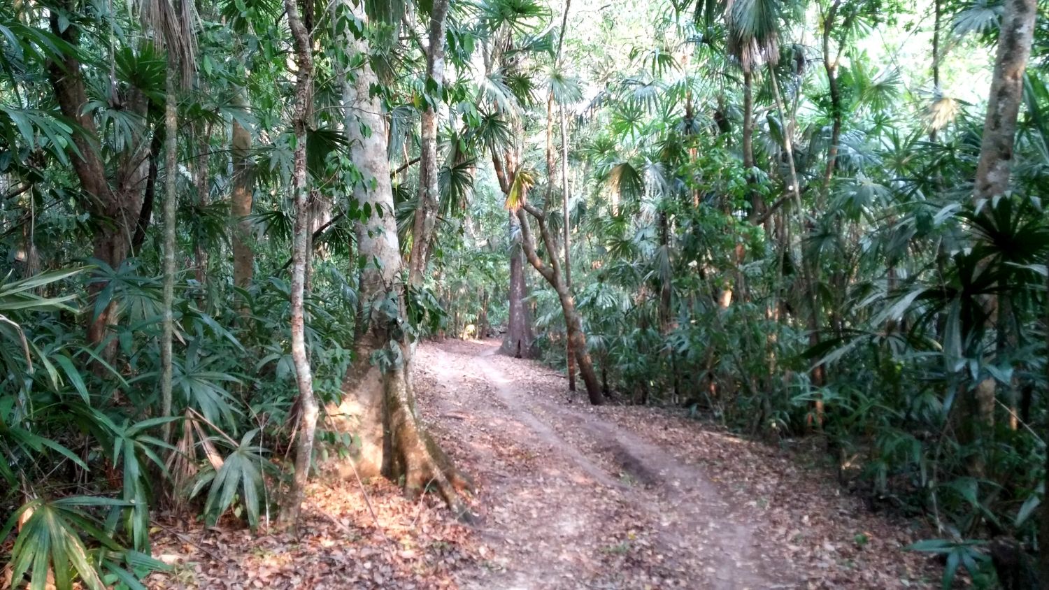
But because the Waká site is extremely remote in the Guatemalan jungle, it’s nearly impossible to bring large equipment or take large volumes of samples. Ricker’s team worked solo with modest hand tools. Austin said GIS completed the picture.
“Archaeological sites are rich in spatial data. GIS allows us to digitally overlay data layers to uncover patterns and relationships that recreate the physical geography of the past.”
Layers of data such as the location and distribution of artifacts and ancient structures, underlying rock layers, and topography contribute great site detail, but there are still voids. Sophisticated modeling can bridge the individual data sets and knit subsurface sampling and aerial drone maps.
“GIS helped fill in the gaps between measured site values to create integrated high-resolution surface models,” Austin said. “The process unraveled an aspect of the Maya civilization that was critical to their survival and uncovered new insights about their infrastructure and existence.”
This integration of soil sampling, LiDAR imagery and GIS modeling goes beyond stacking data. Discipline experts working together throughout the project helped align and shape their methodology. Ricker said this is where collaborative soil science can shine.
Soil is the central concept in nearly every environmental challenge
His current coastal soil carbon projects integrate soil sampling with high-level modeling and machine learning to create data-rich land use maps. But he notes that contrary to popular opinion, soil science isn’t solely agricultural. In fact, most of his lab’s applications are environmental and benefit engineering, ecology, geoscience and a host of other disciplines.
Ancient Lessons For Today
Ricker leverages his arduous field research back in the classroom. While not everyone can tolerate weeks in a jungle tent, soil students get to interact with his international cache of soil data and photographs to learn how describing soils can be applied anywhere.
He says that studying ancient civilizations’ soil and water management holds clues about the society’s fate.
“Soil science isn’t one thing. It’s interactions in geology, biology, the atmosphere, hydrology and people,” Ricker said. “These are civilizations that collapsed. It’s often because of natural resource issues or misuse. Since water is an essential resource, it’s important to recognize that the ancient Maya thought about and made great efforts in water engineering and management.”
Want More Discovery?
Crop and Soil Sciences’ research impacts farmers, students and citizens of the world. Follow how our discoveries affect agriculture and environmental science by joining our weekly newsfeed.
If you are a student interested in climate adaptation or soil science, investigate our undergraduate and graduate degree programs, including a deep dive with our soil degree ebook, then join us for a guided email tour of our department and university.
Protecting North Carolina’s agriculture and environment through stewardship is just part of how we are growing the future.
![]()